Paste your text.
For single programmes, offers and new customers: the itinerary text is enough, no integration needed.
 Open demo
 Round trip, world tour, city walk or wedding poster: your itinerary becomes a print-ready map – in eleven designs, as SVG or print-resolution PNG.
The demo starts without sign-up, with sample trips. Your own itinerary texts will follow.
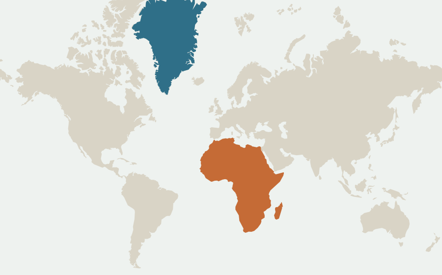
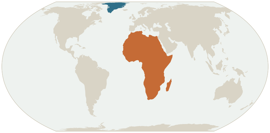
On 4 September 2026 the UN General Assembly adopted the resolution “Correct the Map” (UN press release). It recommends equal-area projections such as Equal Earth instead of Mercator for world and continent maps.
maps.express draws your world and continent maps in Equal Earth on request: from the same data, in the same design, as SVG or PNG.
Africa 30.4 million km²Greenland 2.2 million km²
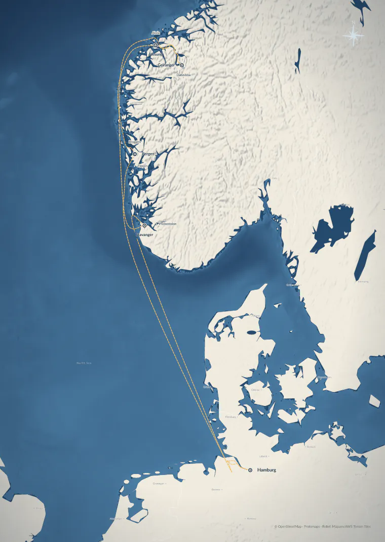
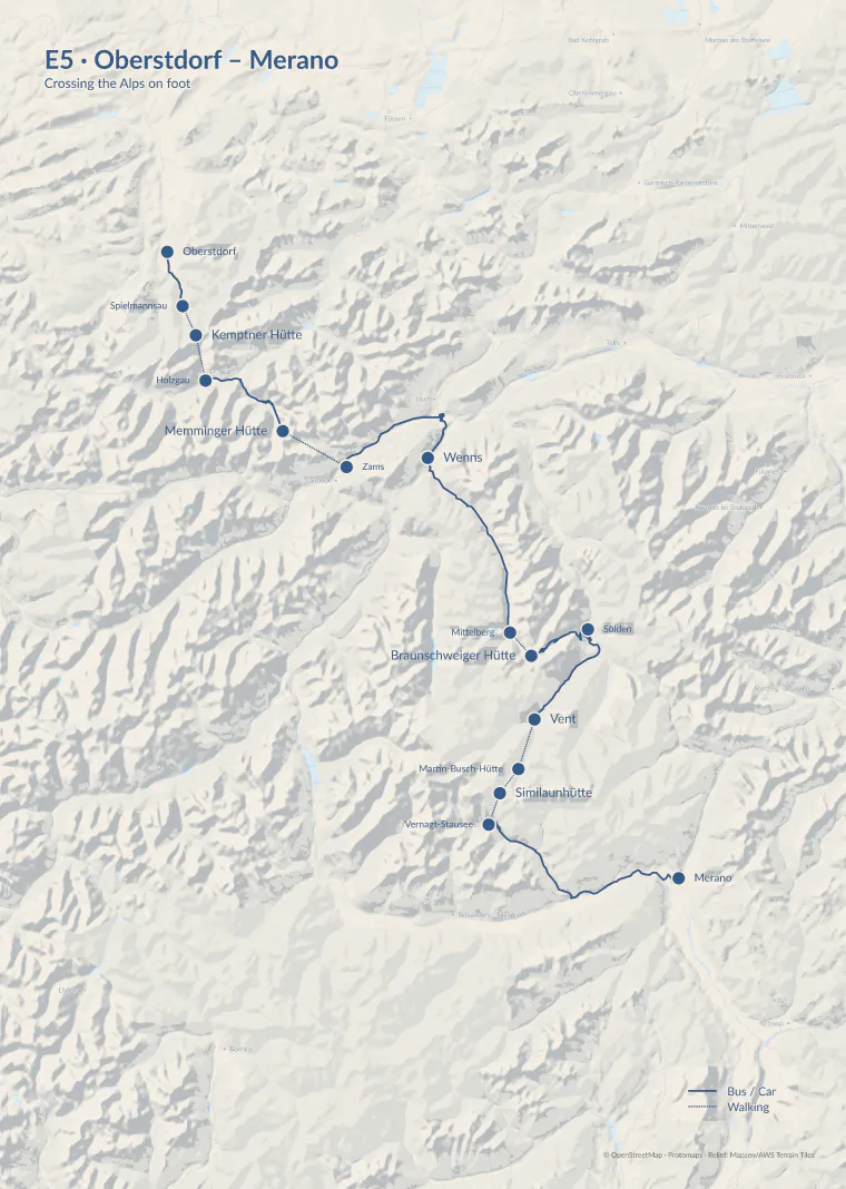
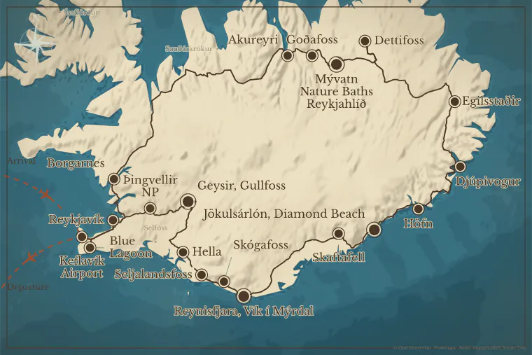
Round trip, cruise, long-distance hike, city walk or love story – every map on this page comes straight out of maps.express. Nothing retouched, nothing redrawn.
All trips are samples, not customer data; every picture is an untouched export. Map data © OpenStreetMap · Protomaps · Terrain: Mapzen / AWS Terrain Tiles.
AI reads stops and transport from your text, and fixed checks verify every result. You look over the places and export. With a clear itinerary that takes three minutes – often less.
Unclear places or elaborate design take a little longer. SVG and PNG are prepared for your print layout; you handle print approval and CMYK conversion in your layout software as usual.Places, order and transport are already in your itinerary. The preview shows what was recognised – for unclear places you pick the right one via search.
Try an example ↗The demo shows the flow with prepared examples.Day 1: Arrive in Zurich, Switzerland.
Day 2: Take the bus to Lucerne.
Day 3: Continue to Interlaken.
Day 4: Take the train to Montreux.
Day 5: Travel by boat to Geneva.
Short map labels · transport modes · places to review
For single programmes, offers and new customers: the itinerary text is enough, no integration needed.
With a connected travel system, the itinerary comes straight from there. Which systems can be connected, we work out together.
From the first place to the finished file for your designers – and you decide what goes on the map.
Copy an itinerary or select a connected trip. AI suggests the main stops and short map labels.
Short names, clear legs, more space. Move labels by hand and hide details that don't tell the story.
As a vector graphic or high-resolution image. If you like, the editing state travels along – for later changes.
One click on a design and colours, type, base map and lines change together. Then fine-tune any layer – or simply leave it as it is.
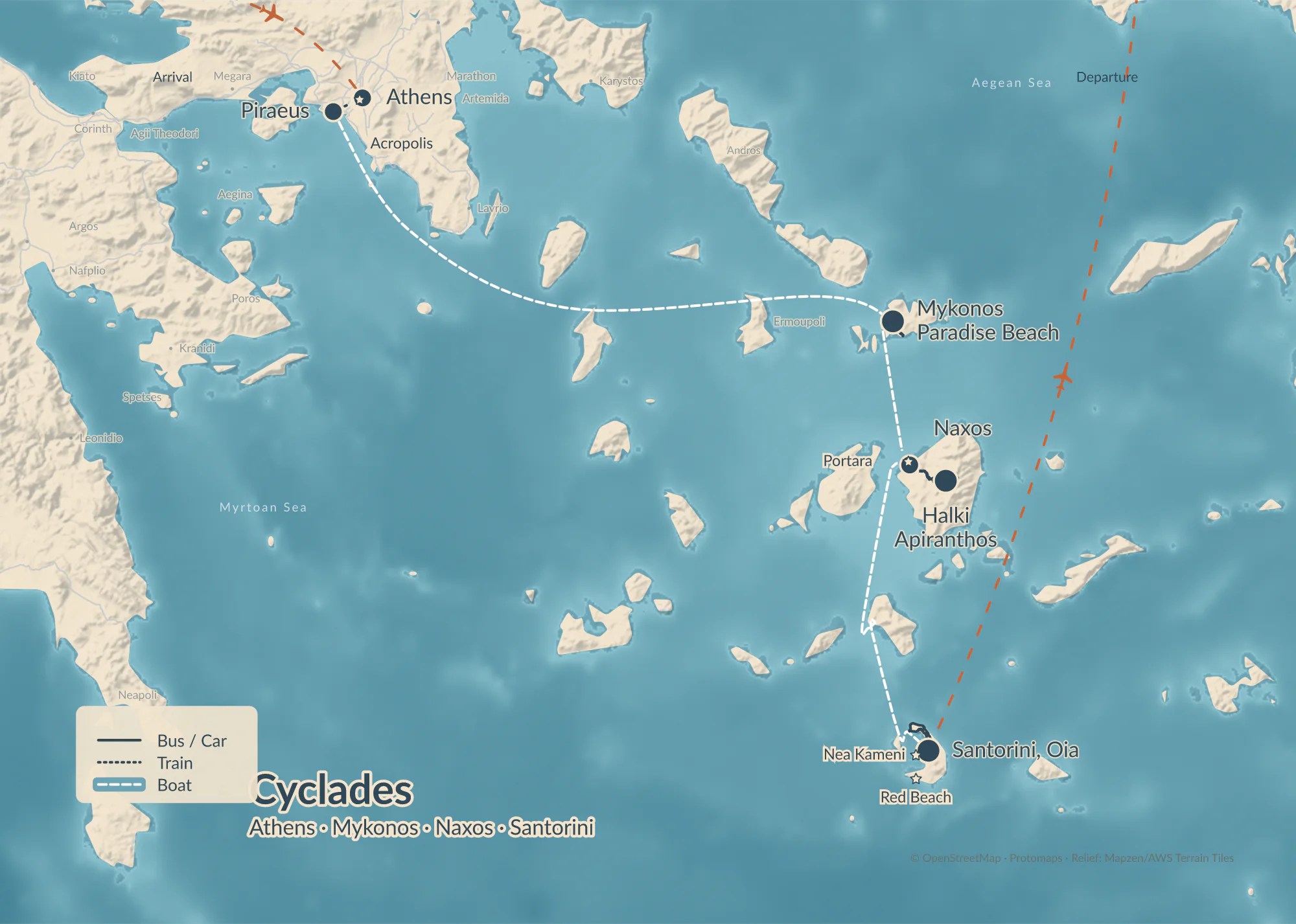
Ten of the eleven designs on the same trip, each exported untouched. Colours, layers and labels stay adjustable; we store your brand fonts and colours in your customer profile.
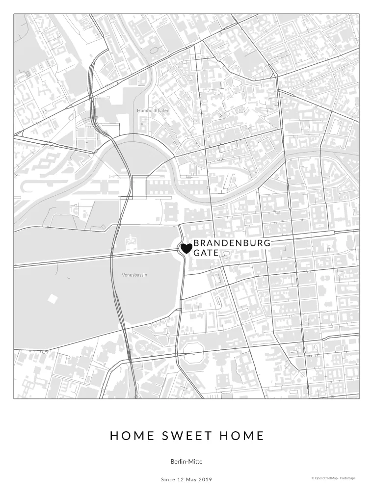 A heart, not a dotHeadlineNote & date
Gift, wedding, anniversary or your own home: set a headline, subtitle and personal note right in the studio. And special places get a heart.
The key actions, right on the map. Suggestions instead of mandatory fields. Just as much detail as your story needs.
“Improve map” finds hidden names, lines running through labels and stops at the edge of the sheet – and proposes fixes: route roads, free up names, fit the frame. With AI, a vision model also looks at legibility and design. You see every change beforehand in a comparison and can simply switch it off.
Example: the same Iceland trip before and after routing the roads – both untouched exports.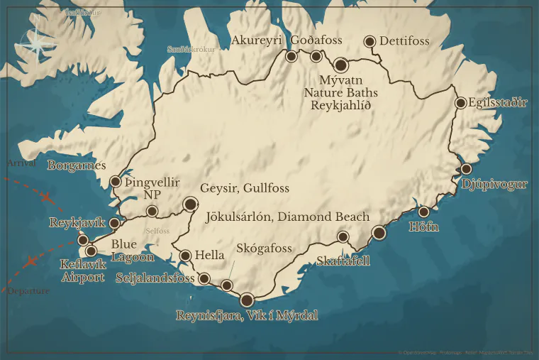
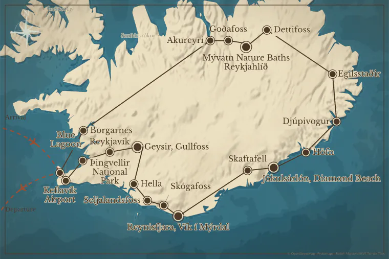 BeforeAfter
AI suggests short map names and separates main stops from side trips. You compare original and suggestion and keep only what fits.
Illustration of the suggestion feature; it always works from your own itinerary.Labels arrange themselves. For the final touch, drag a name where you want it – leader lines keep it connected to its place.
Try it right here. Very dense maps sometimes still need a manual touch.Bus and car legs follow the real roads – for all legs at once if you like.
Car, bus, train, ship, flight and on foot – each with its own line style and one shared legend.
Show or hide terrain, peaks, water, roads, places and borders one by one, each in three strengths.
From city maps with streets and buildings to world maps, even across the date line.
Search places and sights right in the editor, and add or replace stops without rebuilding the route.
Add a symbol for accommodation, a hire car or a station — with or without a label.
Studio and map labels in German, Swiss German spelling and English.
Stops can be hidden without losing the route. The editing state travels with the export, so you can reopen the map later.
Select a point. Change a name. Move a label. The relevant settings appear alongside it.
Behind the studio is a platform. So maps can also be made without a single click in the editor: from your travel system, your editorial system or in a chat with an AI assistant.
In pilot · access on requestmaps_from_itinerarymaps_updatemaps_renderDone: 24 stops, road routes calculated. Shall I open the map in the studio?
Create, edit, render and export maps – with revision protection, preview images and print export.
AI assistants such as Claude turn an itinerary into a finished map, change it in conversation and open it in the studio on request.
A browser agent works the studio through 13 tools – you confirm every change yourself.
The studio inside your platform – with your fonts, colours, export rules and your sign-in.
Vector maps stay crisp at any size. For software without SVG there's PNG.
In the compact SVG, text becomes outlines – the map looks the same everywhere, even without the font installed.
With the editing state embedded, you reopen the map in the studio – even if the exported text is already outlined.
Output in RGB as SVG or PNG. Print approval and CMYK conversion happen in your layout software.
The Iceland round trip from the gallery as an interactive map: your travellers fly along it stop by stop. With trips.express every booking gets a link like this.
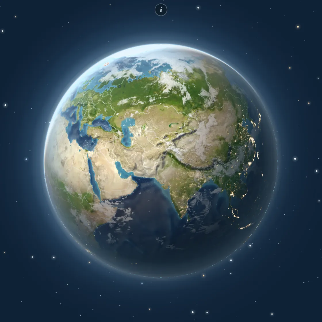
Map: © OpenStreetMap contributors · Protomaps · Sentinel-2 cloudless by EOX (Copernicus), CC BY 4.0 · NASA
Your travellers get a link: the whole trip as an interactive map, day by day, to experience on the globe – building anticipation before the trip and a companion on the way.
Your itinerary becomes a print-ready map in minutes – in eleven designs, as SVG or PNG at print resolution.
Try maps.express in the demo – no sign-up, with sample trips.
Check the places, design the map, download SVG or PNG – and you'll quickly see whether maps.express fits your workflow.
maps.express is in its pilot phase. Your own itinerary texts with AI, the AI map check and bookable plans will follow.
For editorial teams and tour operators we set up brand fonts, export rules and the link to your travel system – to fit your workflow.
We can connect travel data from your booking and editorial systems and tailor maps.express to your workflows. The API for automatically created print maps and the MCP server for AI assistants are running as a pilot – access on request.
Setup, operation and support are agreed depending on scope. Note: your font and data licences must cover the intended use.
No. You edit places, names and connections right on the map; no GIS knowledge needed. The demo shows the flow with a sample trip.
Round trips by car or bus, rail, sea and air connections, hikes, city walks and trips around the world – even across the date line. A single place is enough for a personal poster.
Eleven designs and the paper sizes A5, A4, A3, A2 and Letter, each in portrait or landscape. For websites you export at a fixed pixel width. Colours, layers and labels can then be adjusted freely.
With fixed rules. Every stop the AI recognises must be backed by a passage from your input; for arrivals and departures the passage must also name the transport. Instructions to the AI hidden in the text are ignored. You then pick the right places in the preview. That catches many errors – but the final check of the content stays with you.
Yes, as a pilot: through our MCP server, assistants such as Claude create maps from an itinerary, change them and return preview images. In the studio, a browser agent can help via WebMCP – you confirm every change yourself.
Yes. SVG is meant for vector workflows; PNG can be placed in any common layout program. Editable SVG text needs the matching font; compact SVGs contain outlines instead. Best check the import once in your program version.
OpenStreetMap must be credited – in publications wherever your other sources are listed, for example in the credits. The address openstreetmap.org/copyright must be written out. View requirements
Yes, if you include the editing state when exporting and the metadata stays intact. Changes you make afterwards in a graphics program don't flow back into the studio draft.
Yes, in custom installations: we connect your travel API through a suitable adapter. For a new data provider we first check structure, permissions and the fields needed.